
Adding Survey & Aerial Maps to Your Dashboard
The SiteHive Dashboard Map lets you enhance your site view with high-resolution aerial imagery and survey maps. You can:
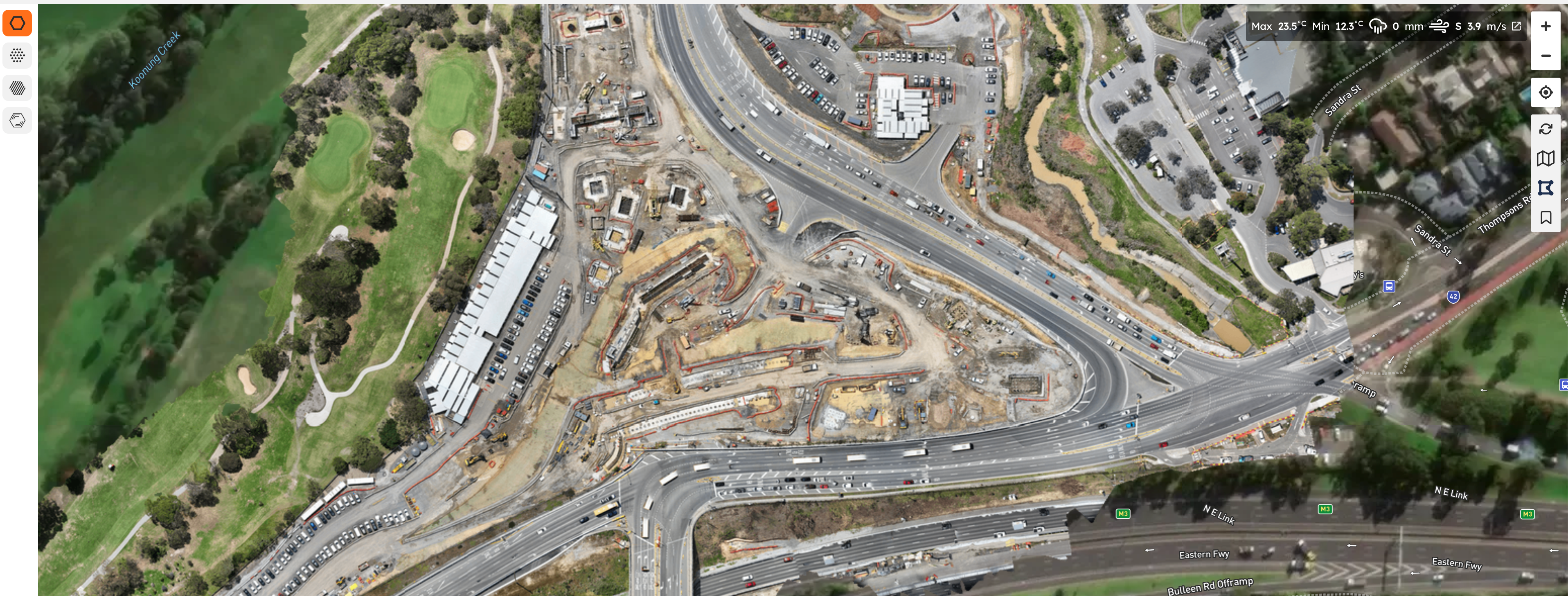
Integrate with Propeller Aero for up-to-date drone survey maps.
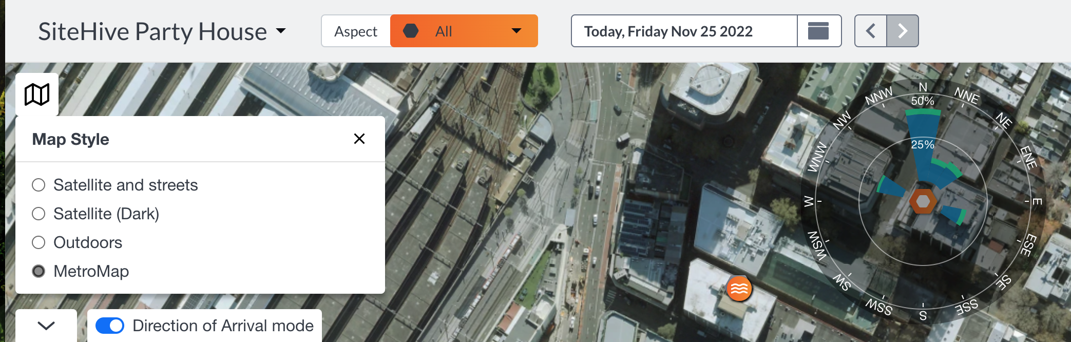
Use MetroMap and Nearmap for high-quality aerial imagery.
These integrations give you better visual context, making it easier to manage and report on your monitoring data.
🔎 Quick Search
🚀 How to add Propeller Aero
Why You’ll Love It:
Clear Visuals: Get sharp, detailed views of your project sites.
Easy Access: Log in to your dashboard and explore your site with ease.
Informed Decisions: Leverage precise site insights for confident planning.
How to Set Up the Integration
To connect Propeller Aero to your SiteHive platform, we’ll need a few details from you to configure the Web Map Tile Service (WMTS).
How to use web map tile service (WMTS)
What We Need From You:
WMTS Unique Link: This will look something like:
https://webmap.services.propelleraero.com/wmts/site/..........Make sure to copy the entire URL provided by Propeller Aero.
Plumbing It In
Here’s how to link your Propeller Aero map directly into your SiteHive dashboard:
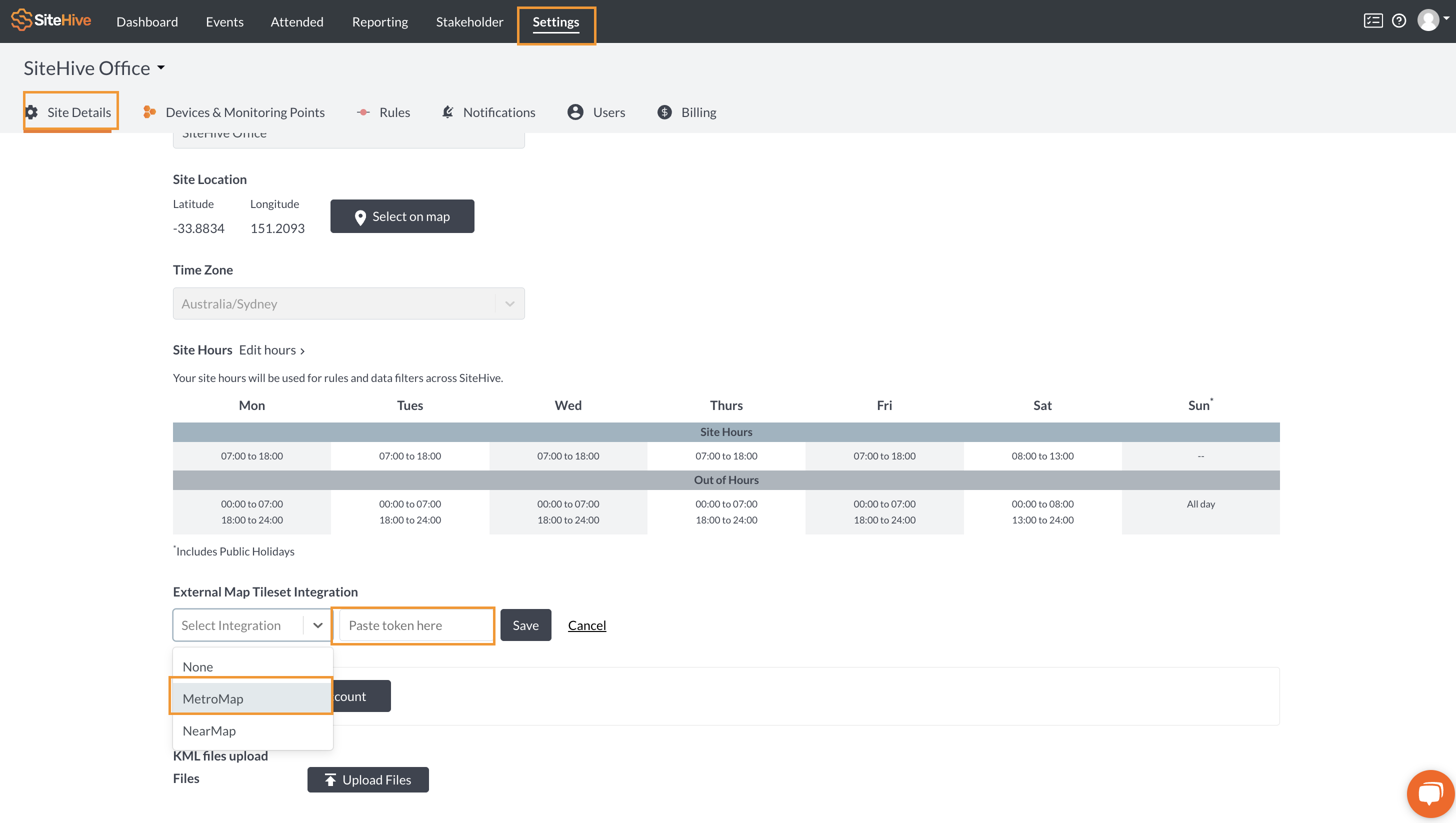
Go to Settings > Site Details.
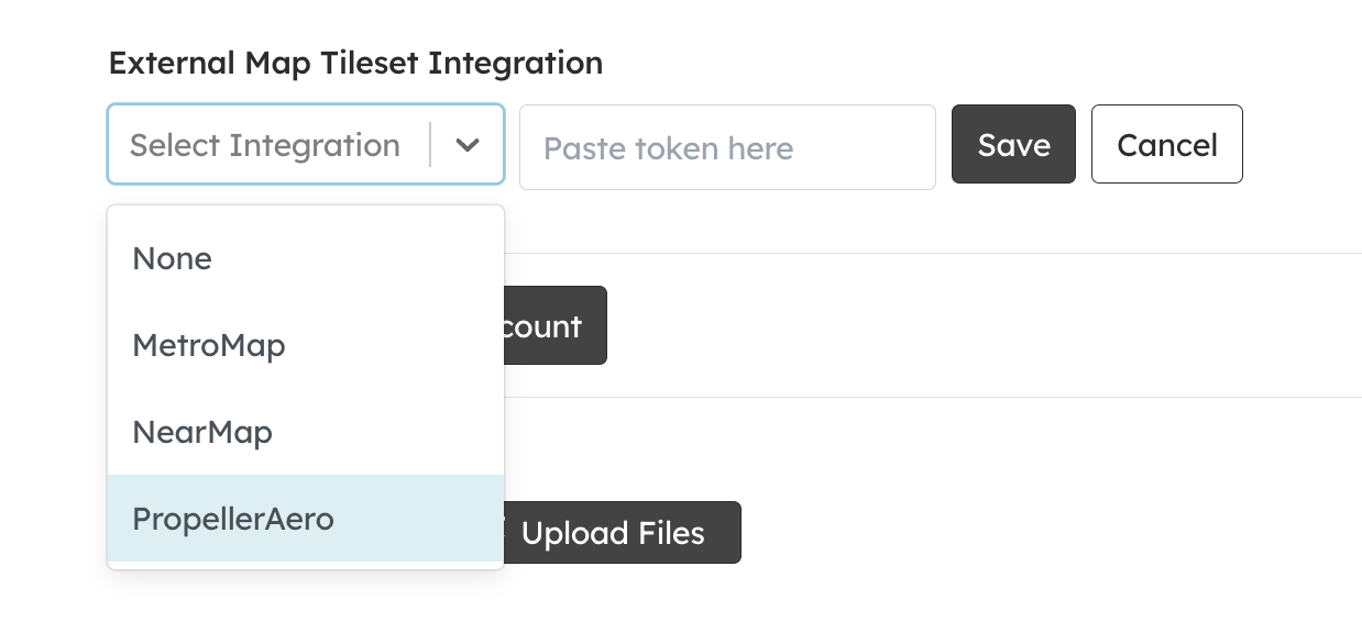
Scroll down to External Map Tileset Integration.
Click Edit and select Propeller Aero from the dropdown menu.
Paste your WMTS Unique Link into the required field.
Save your changes, and voilà! Your Propeller Aero map will now be live on your SiteHive dashboard.
How to add your MetroMap or Nearmap
Log in to SiteHive Enviro
Once signed in - Navigate to the top menu bar and go to 'Settings'
Click 'Site Details' on the second menu bar below your site name
Scroll down to 'External Map Tileset Integration' and click 'Edit'
Once you have clicked 'Edit' you will be able to select your External Map Tileset Integration
Paste or type in your API Token
Click Save
Once saved, in all maps across SiteHive Enviro, your selected service will appear as an option
Need Help?
We’re here to assist every step of the way! Whether you need help gathering the required details or troubleshooting, reach out to us anytime.
📧 Email: support@sitehive.co
💬 Live chat: Located on the Dashboard and Settings tab
📞 Call: 0483 924 329